Posts

Showing posts from July, 2019

ORANMIYAN STAFF OSUN STATE

Image
Ile-Ife is an ancient town with many historic tourist attractions,ranging from the Palace of the Ooni in Enuwa, the Ife Museum and many others. One of the top attractions at Ile-Ife is the Oranmiyan Staff (Opa Oranmiyan). The staff is above 18 feet and has some intricate designs on it. It has myth, history and culture around it. It is a must-see for tourists. A visit to the ancient city of Ife would not be complete without seeing the staff. The Oranmiyan Staff can be seen at the Oranmiyan Shrine at the Arubidi quarter of Ile-Ife.  Although certain traditional rites are performed there, it is still open to tourists. But there are some parts of the shrine that could only be accessed by the initiates. On entering the shrine, the staff could be seen just about 40 feet away. It has a square shaped elevated demarcation made with stones. From atop the demarcation, there are three steps to walk down and get to the staff. It is further demarcated by a metal chain. The base of staff is covere

OSUN OSOGBO SACRED GROOVE

Image
Osun-Osogbo Sacred Grove The dense forest of the Osun Sacred Grove, on the outskirts of the city of Osogbo, is one of the last remnants of primary high forest in southern Nigeria. Regarded as the abode of the goddess of fertility Osun, one of the pantheon of Yoruba gods, the landscape of the grove and its meandering river is dotted with sanctuaries and shrines, sculptures and art works in honour of Osun and other deities. The sacred grove, which is now seen as a symbol of identity for all Yoruba people, is probably the last in Yoruba culture. It testifies to the once widespread practice of establishing sacred groves outside all settlements. Brief synthesis  A century ago there were many sacred groves in Yorubaland: every town had one. Most of these groves have now been abandoned or have shrunk to quite small areas. Osun-Osogbo, in the heart of Osogbo, the capital of Osun State, founded some 400 years ago in southwest Nigeria, at a distance of 250 km from Lagos is the largest

ERIN IJESHA WATERFALLS

Image
Erin-Ijesha Waterfalls (also known as Olumirin waterfalls) is located in  Erin-Ijesha . It is a tourist attraction located in Oriade local government area,  Osun State , Nigeria. The waterfalls was discovered in 1140 AD by one of the daughters of  Oduduwa . However, according to  The Nation ,"Olumirin waterfall was discovered by hunters in 1140 AD" . Another source has it that the tourist site was discovered by a woman called Akinla, founder of Erin-Ijesha town and a granddaughter of Oduduwa,during the migration of Ife people to Erin- Ijesa. The fall features seven floors, on top of which the village Abake is located. The waterfall is said to have medicinal properties and people came from all over to drink from the waterfall and be healed.. Olumirin Waterfall The awe-inspiring falls, also known as Erin-Ijesha Waterfalls is an assemblage of seven distinct cascades located on the south western slopes of the lush Effon Ridge, in Erin-Ijesha town, Osun state

SOBI ROCK

Image
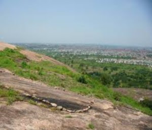
The popular saying among sons and daughters of Ilorin is that Ilorin and despite the fact that Sobi Rock had been in existence before Ilorin came to be. The meaning here is that Sobi rock in Ilorin is predominantly identified with Ilorin. An age long praise song about Sobi rock rendered by the Magaji of Sobi community, Alhaji Mohammed Bello Ajadi, while speaking with the Nigerian Tribune, gives credence to the recognition accorded the sprawling and magnificent creature. “Sobi befits Ilorin, Ilorin befits Sobi just like Mapo Hill befits Ibadan land. Sobi alamira, omo afi asa p’erin. Omo m’ekulu toletole. Omo a b’ogun Ile, ki a to b’ogun ode.” The Magaji said that Sobi rock became so famous, through his forefather, who came from Igbaja. “Elese oba Igbaja, Ajiboro was an hunter. He was on hunting expedition to this place. He actually cleared his way to the place and not that he planned to settle at a particular place. He met some people here though”, he said. Sobi r

OKUTA ILORIN

Image
Ilorin, the present day Kwara State capital city, located in the North Central region of Nigeria and one of the ancient cities in the country, is known with many artefacts and historical items which many especially the younger generations do not know much about.   The stone called Okuta Ilorin (stone for sharpening metal objects or iron) is one of such historical items in Ilorin which is also listed as one of the tourist attractions in the state by the state government for possible development. The stone, according to Daily Trust findings, has a clue as to how the town ‘Ilorin’ derived its name. It is the stone that one of the founders of Ilorin, known as Ojo Isekuse, used to sharpen his iron tools.  In the past, the stone was deified and worshipped but nowadays it is preserved onlyas a historical piece and no longer worshipped.   One of the elders living in one of the surrounding compounds where the stone is located and who conducted our correspondent round the artefact, Alhaji Idri

ESIE MUSEUM

Image
Esie is an Igbomina Yoruba town in Kwara State of Nigeria lying about 48 kilometres South-East of Ilorin and about 128 kilometer north of Ife. Esie is generally known as a home of 800 soapstone figures. The Origin of Soapstone figures is bewildering. Till date, it still remains a mystery. Indeed, nobody knows how these stone images exactly came about but a few explanations have been offered by inhabitants of the city. The most popular among them is that the 800 stone images were rebellious settlers who were turned into stone images. The source claimed that these rebellious settlers were from another tribe of Yoruba-Land who sent words to Elesie (traditional chief of Esie land) that they were coming to settle down in his town but to their utter disappointment, they did not see anybody to receive them hence they settled outside the city of Esie. It later became known that these settlers became a threat to the security of the city. They were undermining the administration of the chief a

JEBBA

Image
Jebba  is a  Yoruba , and  Nupe , city in  Kwara State ,  Nigeria . It has views of the  River Niger  and as of 2007 had an estimated population of 22,411. [1]  The town has the benefit of being split into North and South Jebba. South Jebba falling in Kwara State and North in  Niger State . It is home to the largest papermill in West Africa, as well as being the proud of home of one of Nigeria’s, three Hydro Electric Damns. Powering the whole of Nigeria, every day. It has also a monument to Mungo Park, in remembrance of the shipwreck which took place there, while he tried to trace the source of the Niger. More recently it has taken in 16 new residents in the form of volunteers from Nigeria and the UK. Jebba’s main quality is its mix of Christian and Islamic culture. Transport [ edit ] Jebba has one main road running through it connecting the North and the South of Nigeria. The train station has a functioning yet in frequent service. The railway station is also home to one of the

DADA POTTERY

Image
Dada Pottery is located at the Dada area of Ilorin, the Kwara State capital. The pottery occupies about an acre of land and it is the largest concentration of potters in the state. It is also reputed to be the source of pottery in the town. The Pottery Industry which is touted to be as old as Ilorin itself is being managed by women who are dedicated to the business of pot making. Residents of the area engage mainly in pot making and work full time throughout the year. They neither go on break nor holiday. The Dada area is located at Okelele, Ilorin East Local Government of Kwara State. It is on the left side of the Sobi Specialist Hospital Road, Alagbado, Ilorin while going from Muritala Mohammed Road to Sobi Specialist Hospital; Sobi Hills, and the 22 Armoured Brigade, Nigerian Army, Sobi Barracks. Dada Pottery derives its name from the community: Dada in Ilorin. The potters who are said to be over a hundred women organised themselves in a group and chose a leader for themselves.  T

IMOLEBOJA ROCKSHELTER

Image
Imoleboja Rockshelter: Kwara's rock of refuge The Imolejoba rockshelter is a massive granite rock with inner apartments capable of accommodating a large number of people. In the local dialect of the people it means 'God has built a house'. It is found in Odo-Owa, Kwara state. This is a massive rock formation with natural architectural design, capable of accommodating about 100 people at a time. It is a good site for picnic and monumental experience and culturally viewed by the people as a rock of refuge. The Rockshelter at various times served as a safety hide-out for local maidens protesting against their peers who engaged in pre-marital relations and become pregnant. Location/Accessibility: Located at Odo-Owa in Oke-Ero LGA. It is about 90km from Ilorin the state capital and accessible by road. Accommodation: Available in nearby towns of Iloffa. Time of visiting: All year round Security: Available Bureau of change: Available at the state capital. Located

ASA RIVER DAM

Image
Situated just outside  Ilorin ,  Kwara State  capital city, Asa River Dam was constructed by Julius Berger Nigeria PLC in order to increase the supply of potable water by approximately 50,000 cubic metres per day, to the towns within the state. Asa River Dam consists of three sections: (1). a 400m long earth fill dam, (2). a 150m long concrete gravity dam and (3) a lateral earth dam with a length of 160m. The earth fill dam at 26m high above the bottom of the Asa River and has a width of 150m at the dam foot and of 5m at the crest. The concrete gravity dam is 20m high and has a width of 12m at the foot and of 3m at the crest. The lateral earth dam is 6m high and 23m wide at the foot. Considering the size of the Asa river’s catchment area, the 60 meter wide spillway was designed for a volume of 1,300 cubic metres per second. A 65m long weir bridge was built over the spillway. During the design phase, Julius Berger Nigeria PLC proposed to raise the height of the sp

OWU WATERFALL KWARA STATE

Image
Owu Waterfall Kwara State This heaven on earth is located in Owu Isin Local Government of Kwara State. The existence of Owu falls is untraceable, but the fall has been described as the highest and most spectacular natural waterfalls in West Africa. The water fall cascades 330 feet down an escarpment with rocky outcrops to a pool of ice cold water below which gives a beautiful landscape and offers visitors a refreshing atmosphere. Owu Falls is always at its best during the rainy season which spans 200 meters across making it a wonderful vacation spot. In Owu Falls, you experience a fine mix of awesome attractions and access to top quality accommodation as it offers a range of quality assessed accommodation with good quality restaurants. Its perfect location and memorable vacation experience makes it the perfect destination to host your next vacation.  A fun filled and unforgettable vacation experience awaits you. Owu falls is the highest and most spectacular natural water fall i